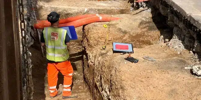
After almost 2,000 years, a section of one of Britain’s most significant Roman roads has been discovered by archaeologists beneath London’s iconic Old Kent Road. This segment is part of the ancient Roman road known as Watling Street.
In 43 AD, the Romans constructed Watling Street, which stretched 276 miles (444 km) from the West Midlands to Dover.
For the first time, researchers have found physical evidence of the Roman highway’s survival directly beneath its modern equivalent.
Although Roman roads are typically straight, finding traces of Watling Street’s path through London has been challenging for archaeologists.
This discovery occurred during the expansion work of Southwark borough’s heat network, revealing a section 5.8 meters (19 feet) wide and 1.4 meters (5 feet) tall.
Gillian King, Director of Archaeology at RPS Consulting Ltd, stated that this discovery has “redrawn the Roman road map” for London, calling it a significant find for archaeological research.
Watling Street, built shortly after the Roman invasion in 43 AD, served as a crucial arterial road in Roman Britain. It extended northwest from the key port of Dover, passing through Verulamium (modern-day St Albans) to the Roman city of Viroconium and the fort of Deva.
The road was significant, used by emperors like Hadrian in 122 AD when he ordered the construction of Hadrian’s Wall, which separated England and Scotland.
Following the fall of the Roman Empire, the Anglo-Saxons named Wroxeter “Wætlingaceaster,” which evolved into “Watling.” The robust construction of Watling Street allowed it to remain a vital part of the medieval transport system, eventually becoming integrated into the modern road network.